EO-Grids
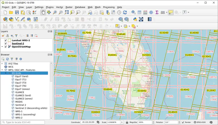
The EO Grids Web Feature Service (WFS) provides global / continental reference tile grids which are commonly used by EO data providers, e.g. vector layers of:
- Landsat 1-3 footprints in World Reference System 1 (WRS-1, global coverage, ascending & descending)
- Landsat 4-8 footprints of World Reference System 2 (WRS-2, global coverage, ascending & descending)
- Sentinel-2 MGRS Tiles (global coverage) and orbits
- MODIS Sinosoidal Grid (global coverage)
- GLANCE tiling scheme (7 continents)
- Equi7 tiling scheme (7 continents)
Overview available vector layers
You might connect to the EO Grids WFS via:
- WFS 1.1:
https://ows.geo.hu-berlin.de/cgi-bin/qgis_mapserv.fcgi?MAP=/owsprojects/eo-grids/eo-grids.qgs&service=WFS&request=GetCapabilities& - WFS 3.0:
https://ows.geo.hu-berlin.de/cgi-bin/qgis_mapserv.fcgi/wfs3/?MAP=/owsprojects/eo-grids/eo-grids.qgs
To visualize an EO Grids Layer in QGIS
-
Connect to the EO Grids WFS
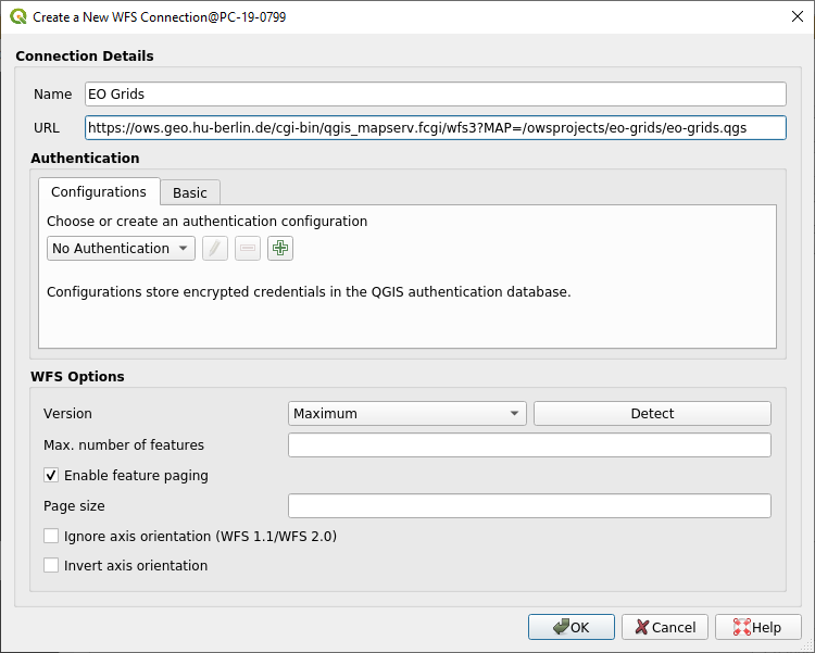
Step 1: Add a WFS connections to QGIS -
Select a layer and click “Add”
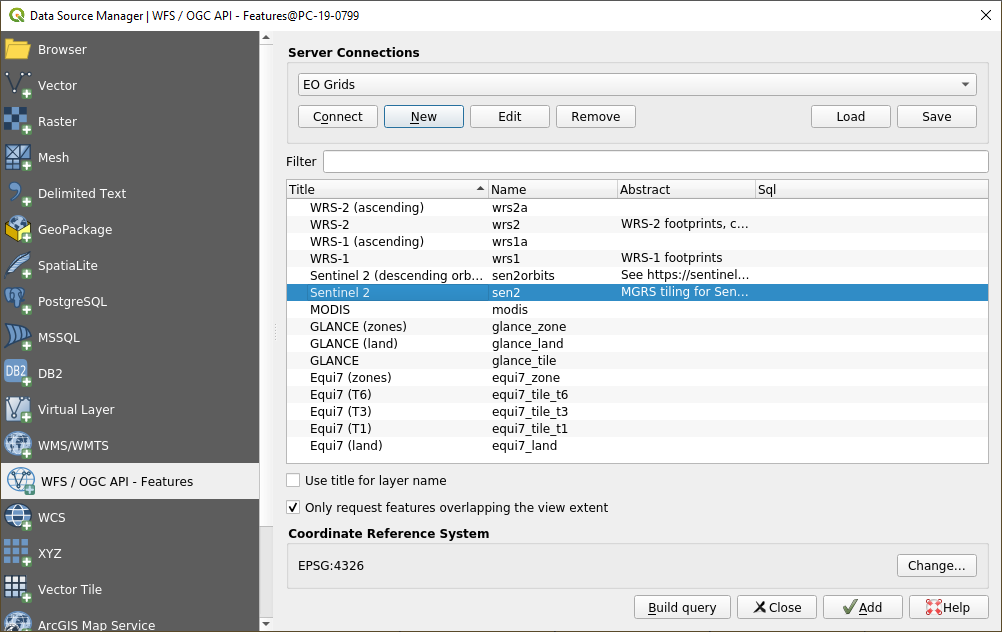
Step 2: Add EO Grids Layer to QGIS