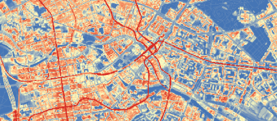
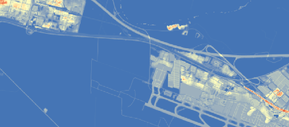
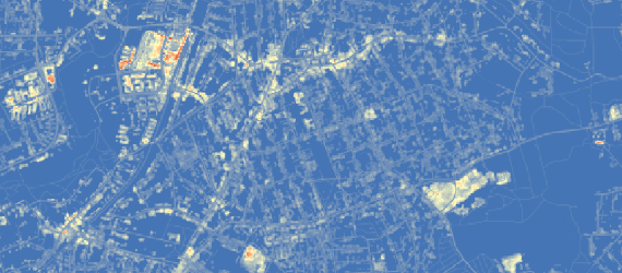
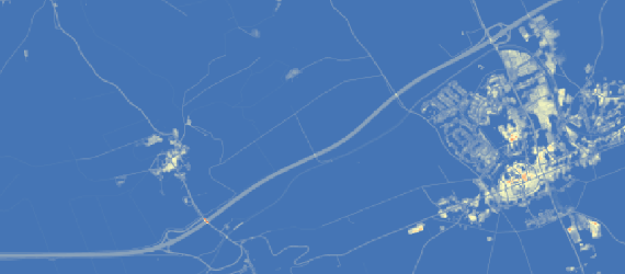
Using remote-sensing data to map material stocks in buildings and infrastructures in Germany and Austria
Publication: Haberl, H.; Wiedenhofer, D.; Schug, F.; Frantz, D.; Virág, D.; Plutzar, C.; Gruhler, K.; Lederer, J.; Schiller, G.; Fishman, T.; Lanau, M.; Gattringer, A.; Kemper, T.; Liu, G.; Tanikawa, H.; van der Linden, S.; Hostert, P. (
2021).
doi: 10.1021/acs.est.0c05642
Web: Schug, F. // franz.schug [ at ] geo.hu-berlin.de
Humboldt-Universität zu Berlin //
Earth Observation Lab
Univ. of Natural Resources and Life Sciences, Vienna //
Institute of Social Ecology
Last Update: 29 March 2021