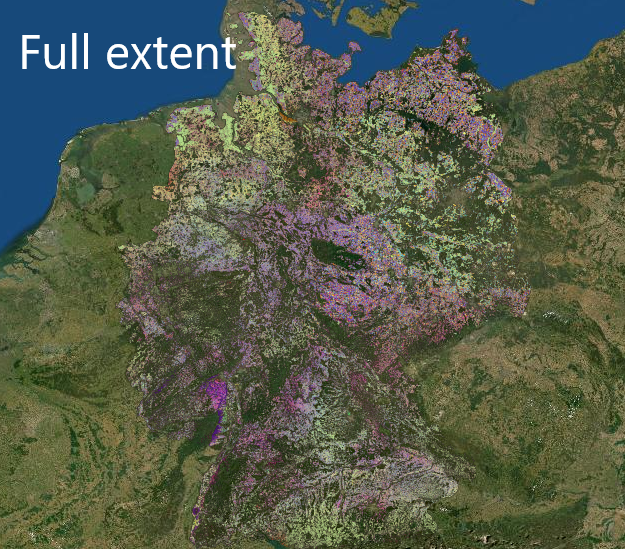
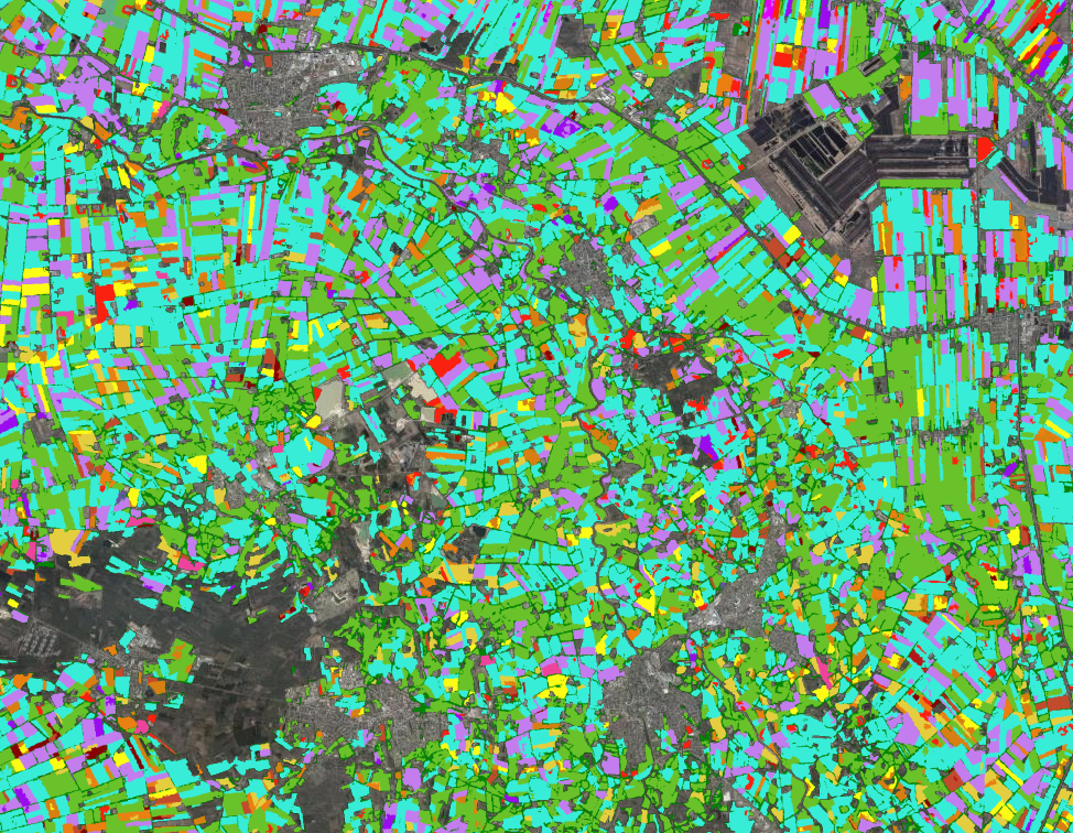
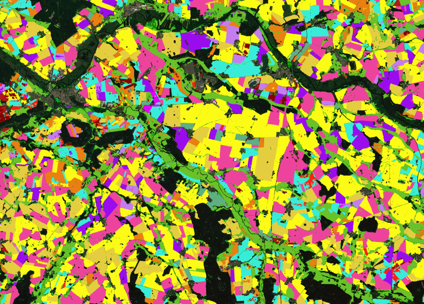
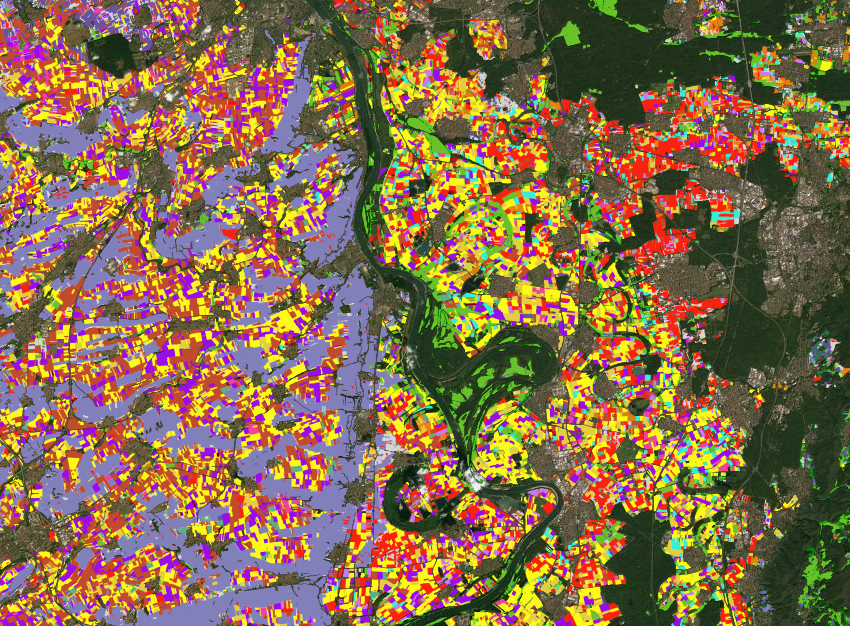
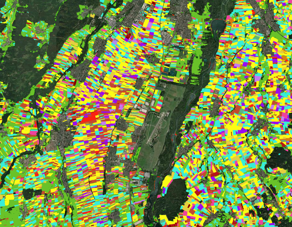
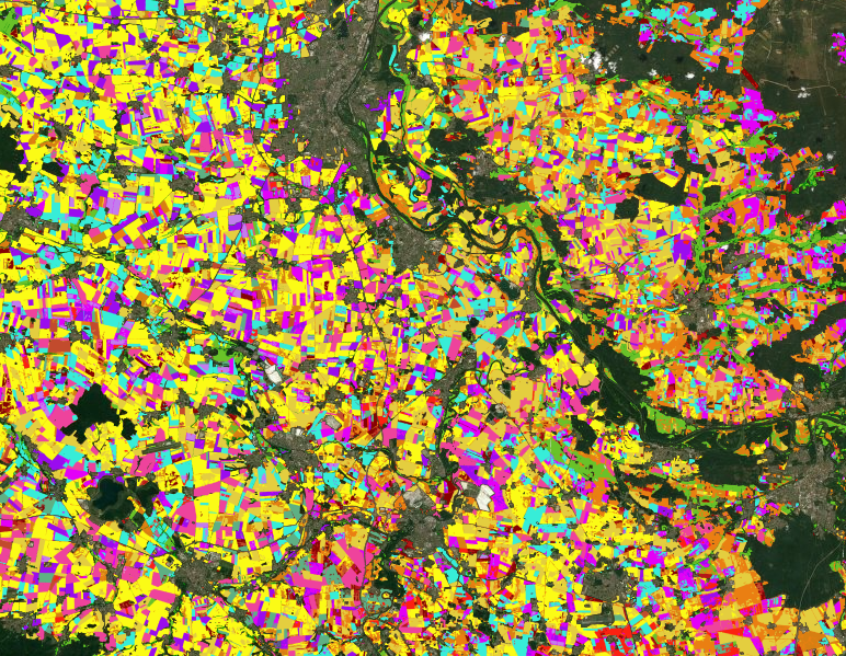
Das technisch-methodische Vorgehen zur Erstellung der dargestellten Karten ist beschrieben in:
Blickensdörfer, L., Schwieder, M., Pflugmacher, D., Erasmi, S., Nendel, C., Erasmi, S., Hostert, P. (2022).
Mapping of crop types and crop sequences with combined time series of
Sentinel-1, Sentinel-2 and Landsat 8 data for Germany, Remote Sensing of Environment, Vol. 269.,
https://doi.org/10.1016/j.rse.2021.112831.
Weitere Links:
Karten Download:
https://zenodo.org/record/5153047#.Yl6RTaSbHDs
Humboldt-Universität zu Berlin //
Earth Observation Lab
Thünen-Institut //
Thünen-Fernerkundung (ThEO)
Leibniz-Zentrum für Agrarlandschaftsforschung (ZALF) e.V.
Zuletzt bearbeitet: 19. April 2022